History in Minnesota
Table of Contents
Bibeau Land in Ramsey County. Paul, Minnesota
Bebeau Land in Hennepin County, Minnesota
Bebeau Land in Polk County, Wisconsin
Bibeau Land Ramsey County Paul , Minnesota
Family history says that in 1847-48 Paul Bibeau
purchased 160 acres of land on
Edgar Belland (1976, History and Biographies. A History of
[Paul]
Bibeau…acquired 160 acres on Centerville Road near present day Edgerton Street
…”, that “Jean Vadnais settled with his family on land just north of the
Bibeau’s farm”, and that “Garceau’s property also bordered the lake and
extended east to the section line in line with Arcade Street if it were
extended.
The earliest
This corresponds with the description
provided by Belland.
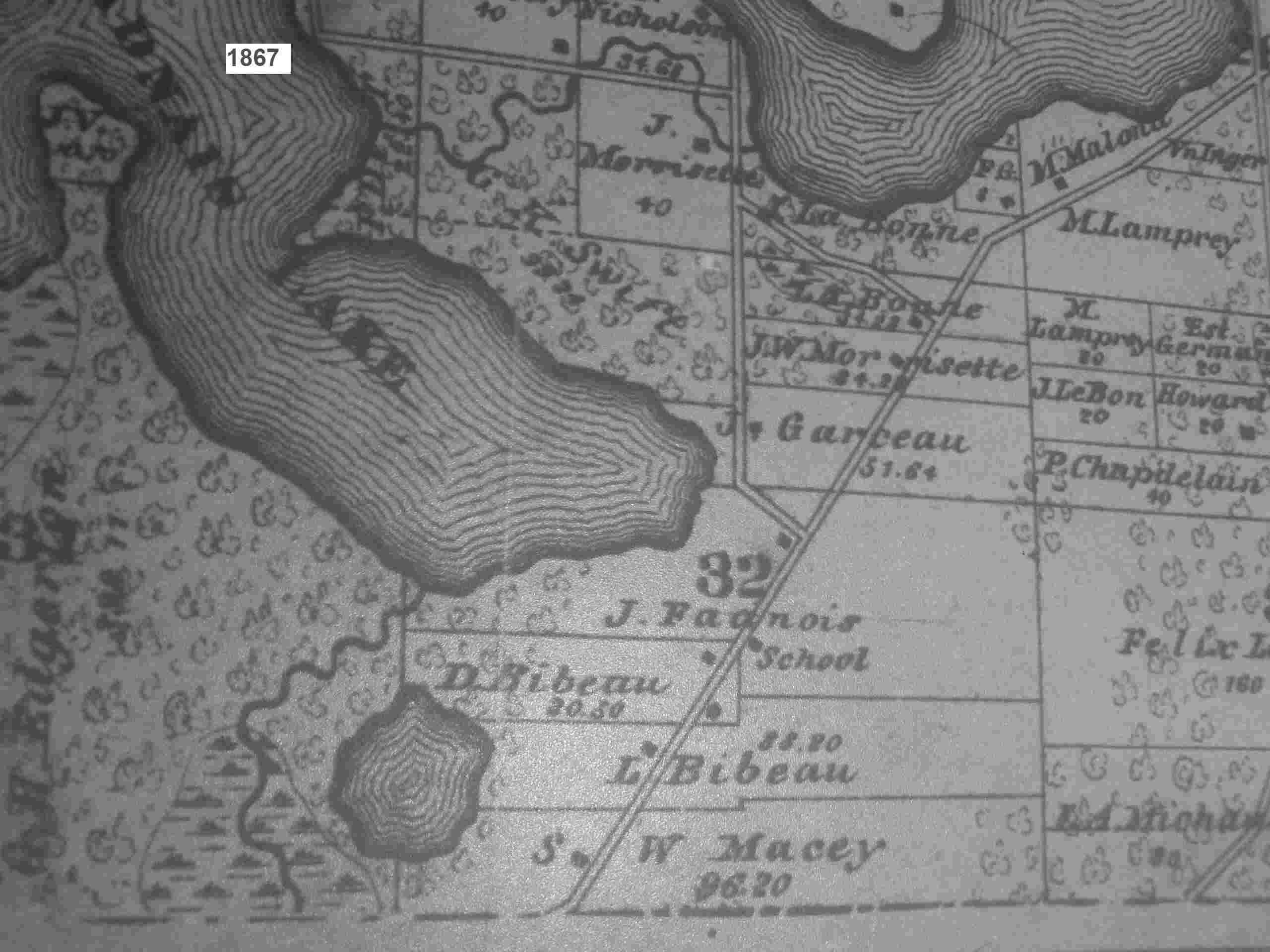
The 1867 maps shows:
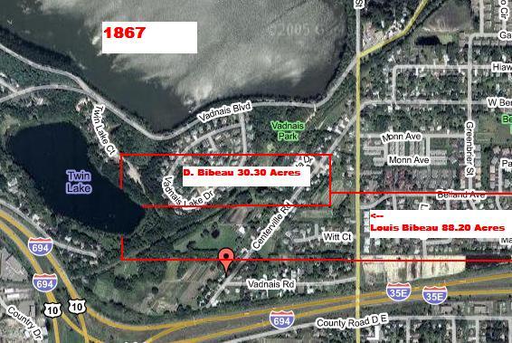
- D. Bibeau (probably David Bibeau, Paul’s son), 30.30 acres.
- L. Bibeau (probably Louis Bibeau), 88.20 acres.
If we overlay this map onto a modern day
satellite map (courtesy of maps.google.com), we can see approximately where
this land lies today.
Unfortunately, the information we have
relative to the land is not complete (as all the land records have not yet been
researched fully). Based on this
information and family histories, we can surmise this:
- In 1847-48 Paul purchased 160 acres. According to
- In 1848 Paul sold his brother Louis half the land, or 80 acres.
- In 1850 the value of Paul’s land (assuming 80 acres) is $320,
according to the 1850 census. Strangely,
there is no record of Louis and his family in the 1850 census.
- In May 1851, Paul sold 28 acres to John Vadnais (possibly J.Fadnais
on the 1867 map).
- Between 1850-1866, Paul may have sold other land, i.e., to
Vadnais, etc.
- In 1866, Paul dies. His
land may have been bequeathed to family or sold, because in 1867 the map
shows:
- 88 acres which may belong to his brother Louis (see L. Bibeau
on the map)
- 30 acres which may belong to his son David (see D. Bibeau on
the map).
- Note: of the original 160 acres, 14 acres are unaccounted for.
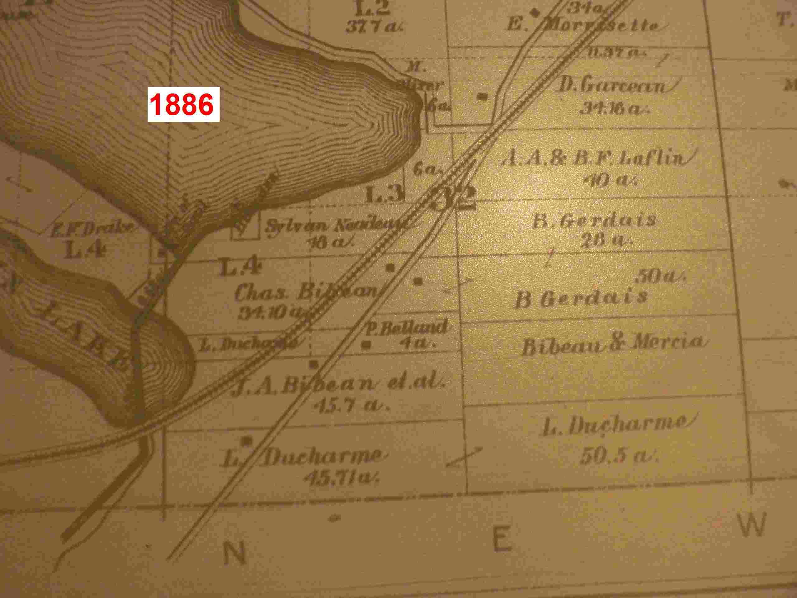
In 1886, the
- Chas. Bibeau (perhaps Charles, Paul’s son), 94.10 acres
- J.A. Bibeau et al (perhaps includes Joseph,
- Bibeau & Mercia, estimated at about 30-40acres.
According to Edgar Belland (1976), for
several years before he died, Louis lived alternately with his sons, Joseph and
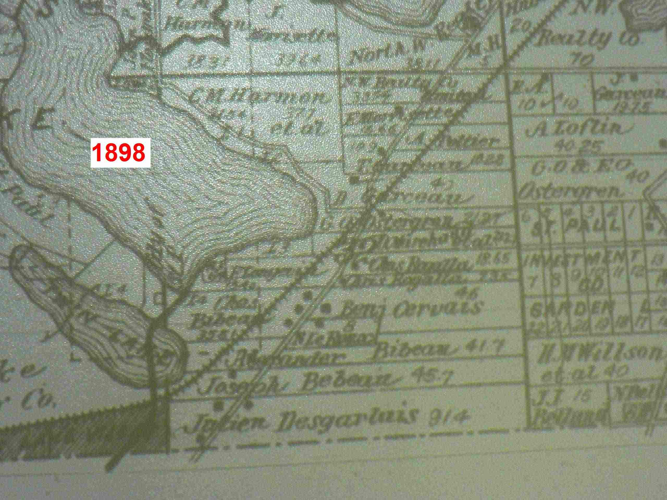
In 1898 the
- Alexander Bibeau (probably
- Joseph Bibeau (probably Louis’ son), 45.7 acres, family history
says he eventually sold the land in 1898 and moved to
- Chas. Bibeau (perhaps Charles, Paul’s son), 35.8 acres
Additionally, there is Bibeau land further
north, on the east side of
·
C. Bibeau (not
sure who), 38.8 acres

If we overlay this map onto a modern day
satellite map (courtesy of maps.google.com), we can see approximately where
this land lies today.
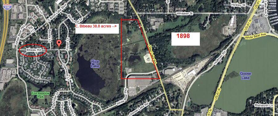
Note the name of the street:
Bebeau Land Hennepin County , Minnesota
We believe that “Petit” Louis and his
family moved sometime between 1856 and 1860 from Little Canada to
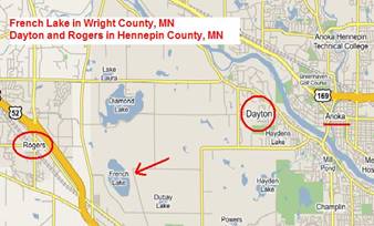
From http://minnesota.state-capitals.com From: http://maps.google.com/
In 1874 the
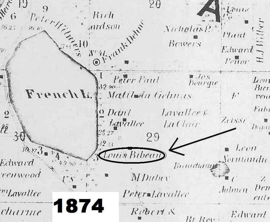
The
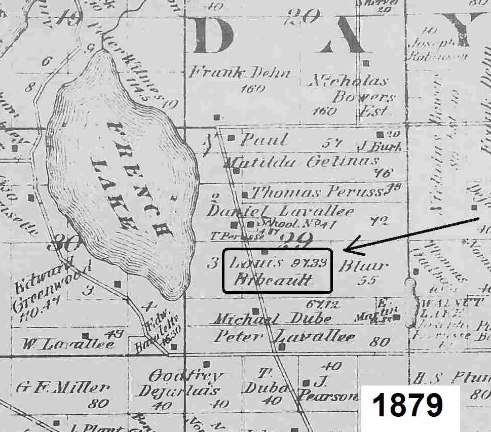
The
·
97.33 acres
belonging to Louis Bebeault (probably “Petit Louis” Bibeau).
·
40 acres
belonging to a Louis Bebo.
· 40 acres belonging to a L. Bileau
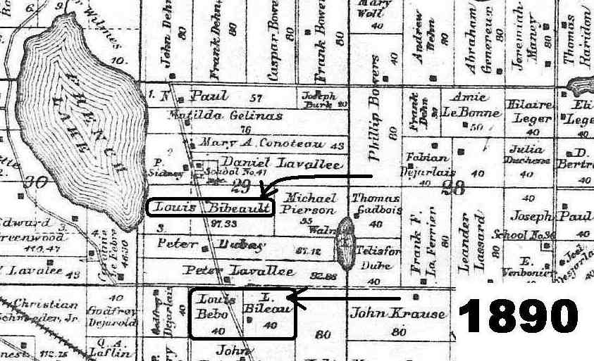
“Petit” Louis Bibeau died
- Peter Bebeau (probably “Petit”
Louis’son):
- 32.33 acres
- 63 acres
- 79.87 acres
- 75.50 acres
- Paul Ribeau or Bibeau (probably “Petit” Louis’ son):
- 55 acres
- 128.91 acres
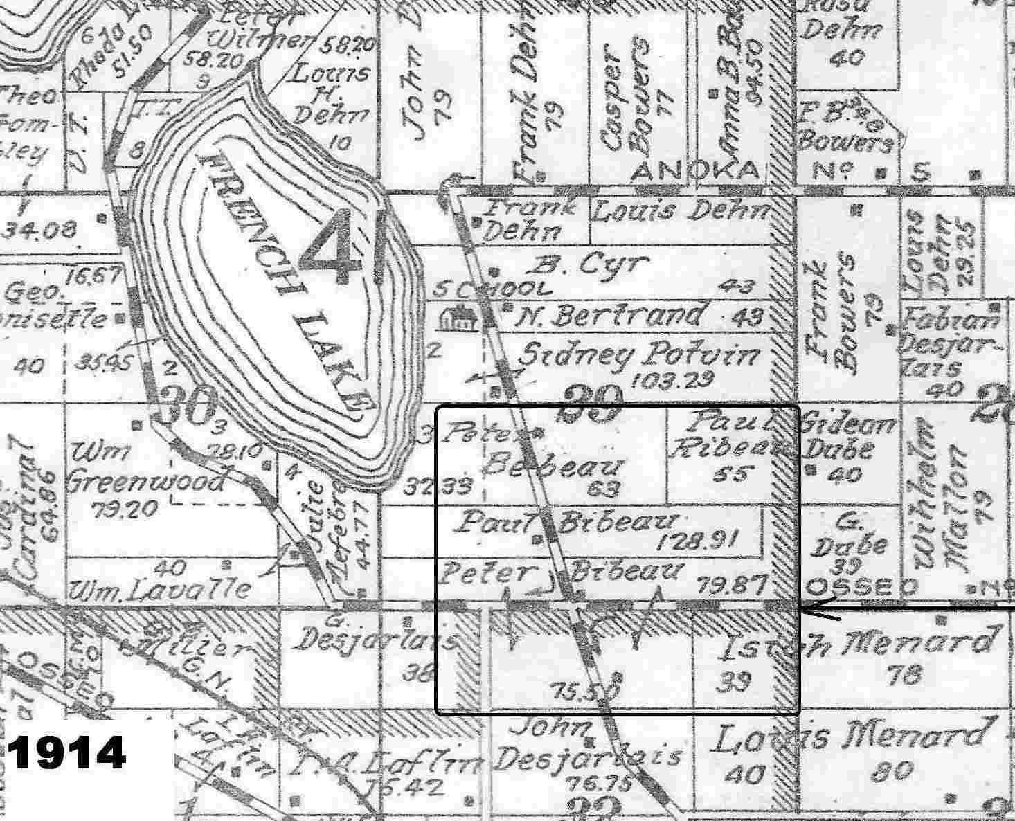
Peter Bebeau was Emily’s father. The 95 acres of land (32.33 acres and 63
acres) on the southeast side of
If we overlay this map onto a modern day
satellite map (courtesy of maps.google.com), we can see approximately where
this land lies today.
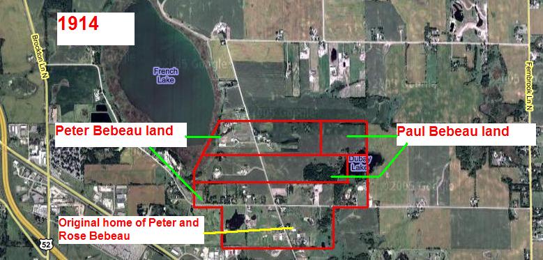
Meanwhile, after Peter and some of the
family moved to
Peter’s other sons, Frank and Fred, lived a
half a mile to the north of the original homestead on
Bebeau Land Polk County , Wisconsin
According to family histories, in 1922 Peter
decided to purchase land near
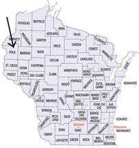
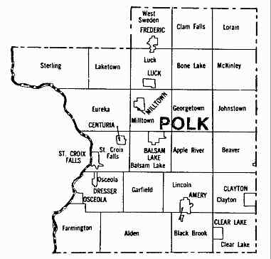
From: http://minnesota.state-capitals.com From: http://www.rootsweb.com/~wipolk/
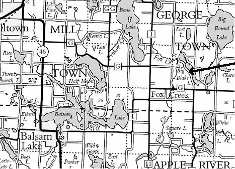
It was here that Peter and his family
farmed, raised dairy cows and made maple syrup which was brought back to
In later years, Peter’s son, Adelore,
rented and farmed his father’s farm in
After Peter’s first wife, Rose, died in
April 1935, Peter’s farm in